Problem it solves
It enables monitoring and early warning of areas prone to hydrogeological instability (slope instability, bradyseism, sinkholes, subsidence, etc.).
Similarly, it monitors and provides early warnings for critical infrastructures such as water pipelines, geothermal energy plants, schools, dams, towers, high-voltage pylons, chimneys, construction sites, bridges, viaducts, railways, highways, river basins, quarries, ports, natural gas storage sites, archaeological sites, historic buildings, etc.
Target users
It is designed for those who manage sites, infrastructures, or areas that need precise, continuous, and real-time monitoring due to potential displacements or deformations.
How it works
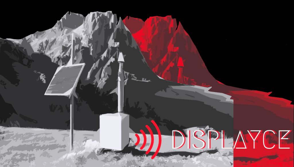
DISPLAYCE sensors are compact, lightweight, and completely autonomous in terms of data transmission and power supply (batteries ensure at least 10 days of autonomy in the absence of an external power source). These features make them easy and quick to install on the ground or on buildings or infrastructures.
The DISPLAYCE system is complete: it includes everything needed for monitoring, such as GNSS sensors, a real-time data transmission system, software for data acquisition and measurement calculations, client applications for visualizing historical data and the status of the monitoring network, and an alert system via email and/or SMS in case of malfunctions or abnormal displacements.
DISPLAYCE receivers are less expensive than traditional instruments used for these applications while offering similar performance. Even with a relatively low budget, it is possible to implement widespread monitoring networks over the area of interest, with enough sensors to monitor the ongoing phenomena effectively.
DISPLAYCE complies with European standards (CE mark).
Source:
It is available the online DEMO of Displayce, insert your data, register and you can access directly from the link.